Web GIS202640.7447° N, 73.9485° W
CityLens — GIS & Urban Intelligence Platform
A geospatial intelligence platform that ranks New York City tax lots for redevelopment and backs every score with source-dated public records, aerial change evidence and LiDAR 3D.
- Role
- Full-Stack GIS Engineer
- Client
- Real estate & acquisition teams
- Timeline
- Ongoing
- Platform
- Web application
- 5NYC boroughs covered
- 5kparcels ranked
- 13public data sources
Overview
The brief
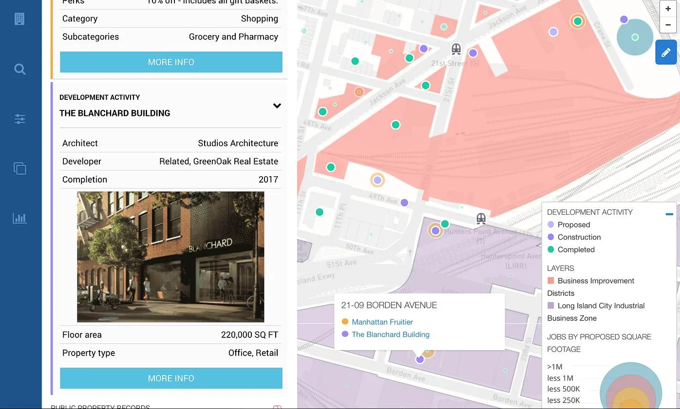
CityLens helps real estate professionals identify, evaluate and prioritize development opportunities across New York City's five boroughs. It combines citywide property screening, interactive mapping, parcel intelligence and source-dated property records into one decision-making workflow.
Challenge
What made it hard
Development-site research means stitching together zoning, deed, permit, tax-lien and floodplain records by hand, with no way to tell how current each source is or whether the buildings on a lot have changed since the records were filed.
Solution
How I built it
A Next.js frontend talks to a FastAPI engine on Cloud Run that handles auth, quotas and artifact storage, backed by a Python pipeline for segmentation, change detection and mesh generation. Parcels are ranked on zoning headroom, ownership, sales and permit history from public sources such as PLUTO, ACRIS and DOB. Evidence runs compare building footprints with aerial imagery, and LiDAR is reconstructed into 3D site models.
Core features
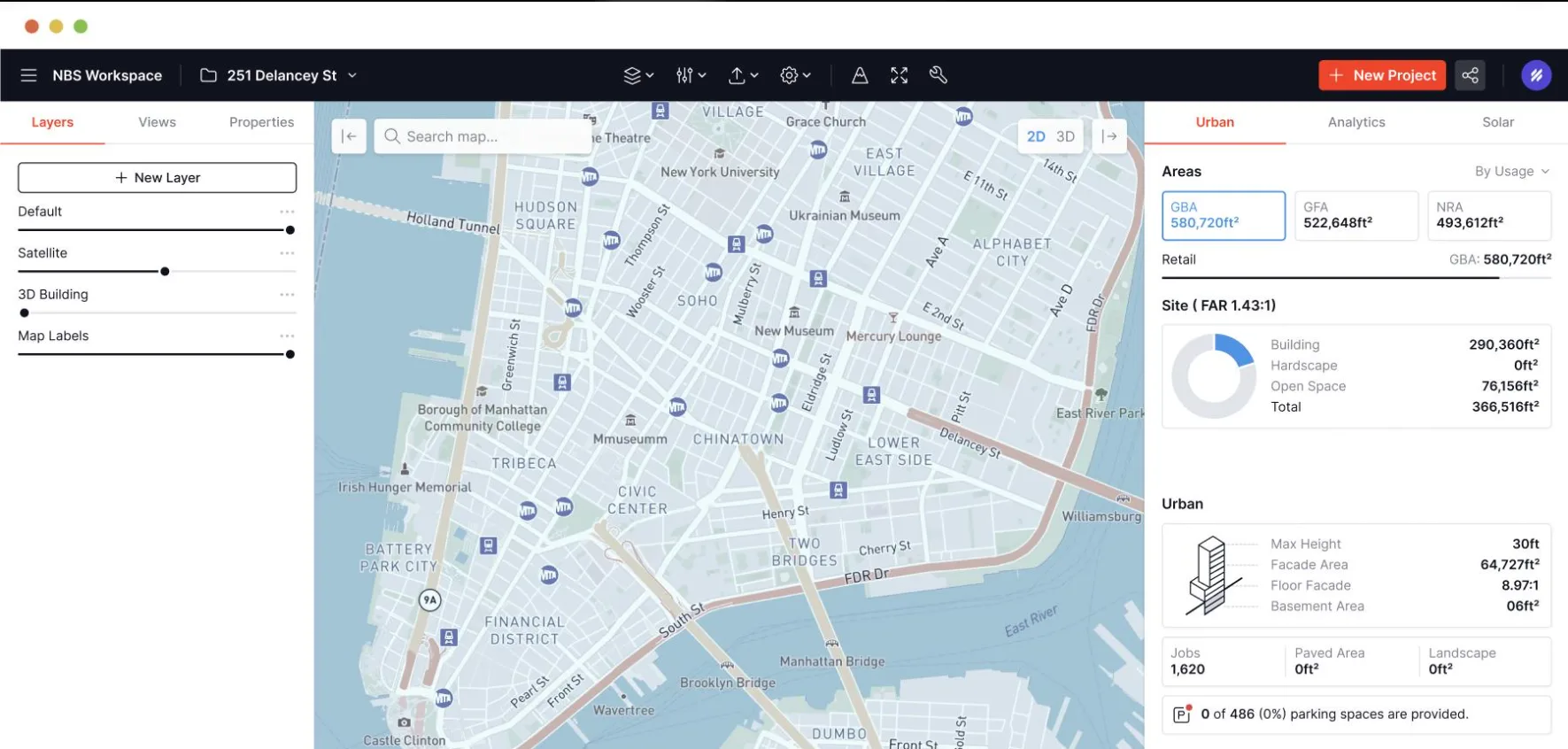
Parcel comparison & site metricsCompare sites on gross floor area, FAR, open space, height and parking from one workspace. 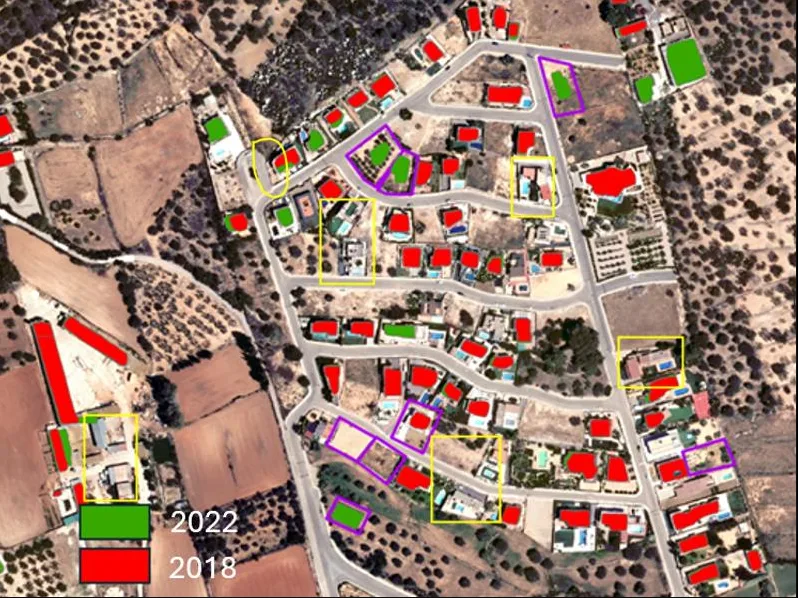
AI building change detectionFootprints from two survey years laid over aerial imagery to flag added, demolished and modified buildings. 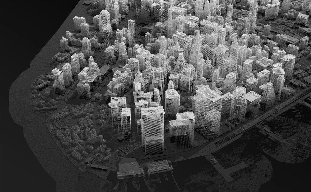
LiDAR 3D reconstructionPoint clouds rebuilt into 3D city models for massing and site review.
Key features
- Citywide screening that ranks NYC tax lots for redevelopment
- Interactive parcel map with zoning, ownership, sales and permit history
- Source-dated property records with a freshness check for every dataset
- AI building change detection on aerial imagery
- LiDAR-based 3D reconstruction for site review
- Parcel comparisons, evidence exports, REST API and reproducible runs
Tech stack
- Next.js
- FastAPI
- Python
- react-three-fiber
- Leaflet
- Cloud Run
- Neon
- Vercel
See it running
Open the live app in your browser.