Mobile GIS202425.2532° N, 55.3657° E
Airport Indoor Wayfinding App
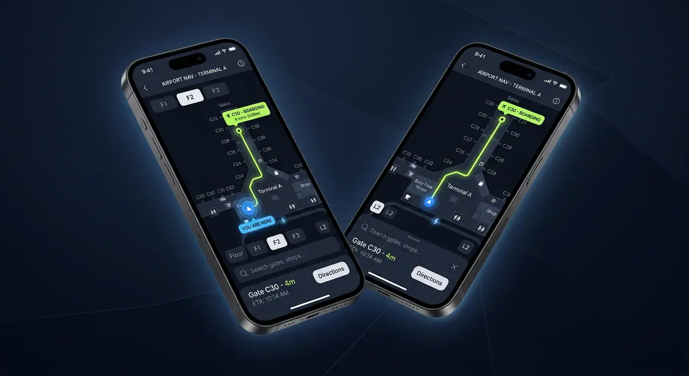
Turn-by-turn indoor navigation across multiple terminal floors, with live gate changes and accessible routes.
- Role
- Mobile & Indoor Mapping Developer
- Client
- International airport
- Timeline
- 5 months
- Platform
- iOS & Android
- 250kmonthly active users
- 3mpositioning accuracy
- 41%fewer missed connections
Overview
The brief
Travelers kept missing connections in a sprawling, multi-level terminal. I built native iOS and Android apps with indoor positioning and turn-by-turn routing between gates, lounges and services.
Challenge
What made it hard
GPS does not work indoors, floor plans existed only as CAD drawings, and routes had to respect elevators, security zones and accessibility needs.
Solution
How I built it
I converted CAD into an IMDF-based indoor data model, generated a multi-floor routing graph, and fused BLE beacon and Wi-Fi positioning with device sensors for meter-level blue-dot accuracy.
Key features
- Multi-floor maps with smooth floor switching
- Turn-by-turn routing including step-free routes
- Live gate changes and walking-time estimates
- BLE beacon + Wi-Fi indoor positioning
- Points of interest search for shops and lounges
Tech stack
- Swift
- Kotlin
- IMDF
- Mapbox SDK
- BLE Beacons
See it running
Install the app and try it yourself.