All projects06 / 10
Web GIS202440.7128° N, 74.0060° W
Municipal Asset Intelligence Platform
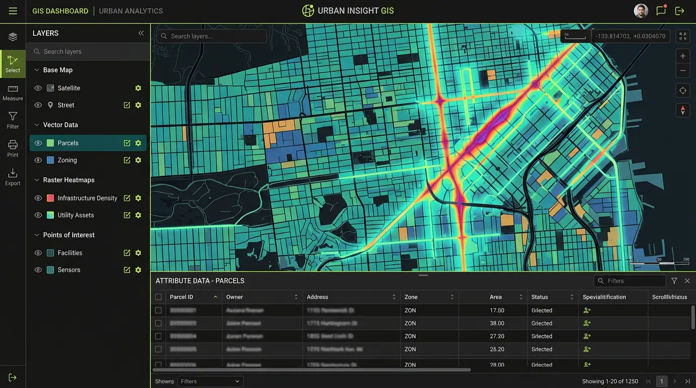
A web platform for managing utility networks and city assets, serving millions of features with live editing.
- Role
- Full-Stack GIS Developer
- Client
- Regional municipality
- Timeline
- 10 months
- Platform
- Web application
- 3.2Mfeatures served
- 9departments onboarded
- 5sedit-to-visible latency
Overview
The brief
Water, sewer and road teams each kept their own spreadsheets and desktop GIS files. I built one shared platform where every department can view, edit and report on its assets.
Challenge
What made it hard
Millions of features, strict permissions between departments, and editors who needed changes visible to everyone immediately.
Solution
How I built it
PostGIS with row-level permissions, Martin serving dynamic vector tiles, and a Next.js frontend with MapLibre for editing. Tile caches are invalidated per-feature so edits appear in seconds.
Key features
- Vector-tile rendering of millions of assets
- Browser-based geometry and attribute editing
- Department-level roles and audit history
- Network tracing for water and sewer
- Scheduled PDF and CSV reporting
Tech stack
- PostGIS
- MapLibre GL
- Next.js
- Martin
See it running
Open the live app in your browser.